If scientists’ predictions are correct, hundreds of San Juan County’s most coveted waterfront properties may be damaged or unlivable within a century.
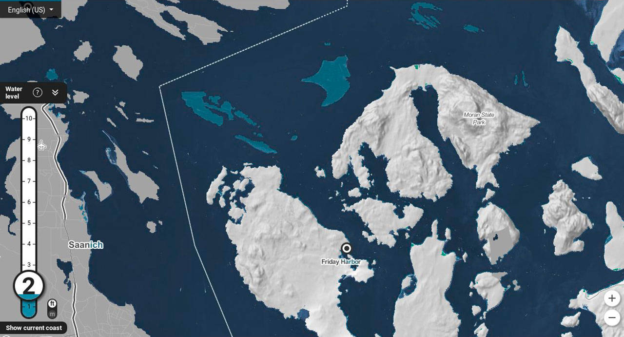
According to the National Oceanic Atmospheric Administration, sea levels in Friday Harbor will rise a median of 2 feet within the next century.
At that height, by 2100, 500 San Juan County homes, worth a total of about $380 million, would be flooded, according to a national nonprofit called Climate Central. The organization’s website states it is comprised of scientists and science journalists, but critics attest it is a climate change advocacy group.
Neither NOAA nor San Juan County has data on the number of local houses affected by possible sea level rises.
Research
Ian Miller, Ph.D., has used Climate Central data to assess economic impacts of local areas. Miller is with the Washington Sea Grant program at the University of Washington, which is part of a national collegiate network, administered by NOAA.
Miller said Climate Central’s data, as well as a recent national report by the real estate database Zillow.com, help translate sea level rise impacts into real terms.
“It tells us the economic impacts and that the real estate community is paying attention,” said Miller. “The layout of real estate in Washington will have to respond to it.”
Climate Central researchers used 2010 U.S. Census housing data to form estimations. They also used regional data from NOAA’s Seattle office on sea level rise and a 2017 NOAA report, which estimates nationwide sea levels could reach as high as roughly six feet in 100 years.
The 2017 NOAA report, titled “Global and Regional Sea Level Rise Scenarios for the United States,” explains that sea level rise is driven by the expansion of the ocean as it warms; melted ice in glaciers and polar ice sheets; and changes in land-water storage.
Clifford F. Mass — a weather blogger and professor of atmospheric sciences at the University of Washington — said these changes occur due to the man-made release of carbon dioxide. According to NOAA, CO2 is mainly released during the burning of fossil fuels, like coal, and helps to trap heat on Earth instead of releasing into the atmosphere.
Sea level in Friday Harbor has risen .38 feet in the last 100 years, states NOAA data. Mass said some of this is based on natural rises from after the ice age, but this rate will accelerate in the latter half of the next century thanks to human activity.
Real estate
Merri Ann Simonson, a broker at Coldwell Banker San Juan Islands, said local waterfront homes are typically the most expensive. Today, the least costly waterfront property that Coldwell Banker has on the market, she said, is $650,000 and less than 1,000 square feet.
However, she admits predictions of sea level rise have not affected the local housing market. Potential waterfront property buyers are more interested in learning about easily seen land changes — like erosion — not subtle alterations over a long period of time.
“If I’m selling a parcel in a bay, with a bluff, you can see dirt coming off that bank,” said Simonson. “That’s when a buyer starts to ask questions.”
Simonson said she often refers interested waterfront property buyers to Land-use Consultant John Geniuch, of San Juan Island, to conduct studies. He hires licensed surveyors to measure the expected water level rise that would occur in a 100-year flood event. Typically, he said, this ranges from 10 feet to 16, depending on the county location. According to U.S. Army Corps of Engineers regulations, structures must be built a foot above those levels. He said the organization also “suggests” to build a foot above that.
These codes, as well as most of the area’s high- or medium-banks, doesn’t create a lot of worry for buyers, explained Roberta Kent, a broker at Island Group Sotheby’s International Realty.
“Most discussions center around erosion, tides, and storm damage, rather than actual sea level rise,” she said.
Rebecca Hughes, a broker with Windermere San Juan Island, said about 15 percent of her clients, looking at waterfront properties, question the risk of rising sea levels. Those concerned often choose higher ground or in-land properties.
“We tell clients to do their own due diligence and draw their own conclusions,” said Hughes. “We won’t know until it happens.”
Erosion and floods
In a 2013 report, Friends of the San Juans and other researchers focused on erosion and floods, in relation to sea level rise predictions. The study concluded that feeder bluffs could erode up to 100 feet, depending on their condition, location and the highest sea level rise projections. Feeder bluffs are steep, shoreline banks that provide the sediment that forms and maintains beaches.
Both Climate Central and Friends of the San Juans based predictions partly off of a 2012 U.S. National Research Council report.
Using online maps of county geographics, researchers concluded that up to 235 county structures would be vulnerable to erosion by the century’s end and 249 by flooding. Structures include roads, homes and other buildings, like those for business and government.
Tina Whitman, with Friends of the San Juans, said locals recognize the concerns. In 2016, she said, an Orcas Island couple moved their house further from the shoreline to restore the beach and ensure the home would be safe in the future.
The county needs more local preparations like this, said Paul Kamin, the general manager of Eastsound Water Users Association.
“Sea level rises are inevitable,” he said. “A lot of people aren’t incorporating it into planning.”
Read the Jan. 10 edition of the Journal to learn more about the effect of sea level rise on county infrastructure. For free site visits from experts on how to protect local shorelines, contact Friends of the San Juans at 360-378-2319 or visit sanjuans.org.
The Climate Central map, below, shows the researchers’ predictions of sea level rise in the San Juan Islands.


